The Branch Line Society (Test)
Guest
Preston Walk
10 participants met walk leader Paul Steane at Bamber Bridge station in warm sunshine to explore tramroad/railway heritage just south of Preston, generally before and after lunch respectively. The first part was largely concerned with the Lancaster Canal Tram Road. Opened 1803 to link the north and south sections of the Lancaster Canal, it was only to be temporary pending the construction of flights of locks, but the canal company never prospered sufficiently to carry this through. Buildings at an angle to the main (old A6) road south of the station indicated the site of a tramroad level crossing. A short walk along local roads brought us to a similar later site - Brownedge Crossing on the East Lancashire Railway (ELR) Bamber Bridge to Preston direct line, CP/CA 1 May 1972, but the keeper's distinctive cottage survives.
We then entered a public nature reserve based on much of the area's network of redundant railway trackbeds. Its name 'Preston Junction' hardly does it justice as it extends well north of that location, renamed Todd Lane Jn in 1952. We soon reached the junction site; nothing remains of the passenger station (CP 7 Oct 1968 when Preston - East Lancs and Preston - Liverpool services were adjusted to connect at Preston, instead of Todd Lane Junction station). However, at road level there is a short terrace of railway workers' cottages, unusual in that the station master's house is built on to one end! We took to the road briefly here before re-joining the tramroad, part of the National Cycle Network but also well used by walkers and runners. It acts as a peaceful buffer zone preventing the roads on either side linking up to become 'rat runs'. Through the foliage on our right we could pick out part of the Penwortham Incline abandoned 1820 when the present route on an easier gradient replaced it.
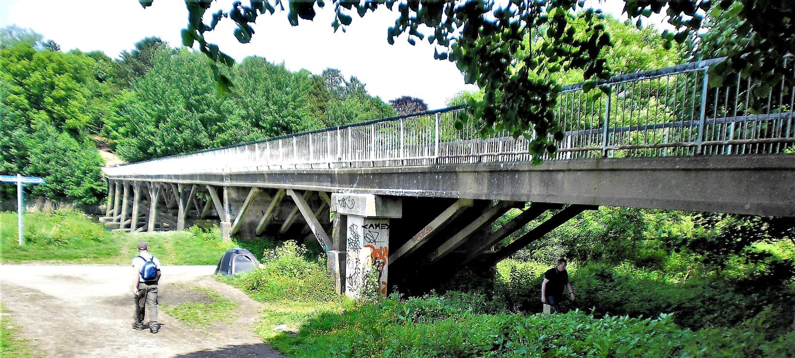
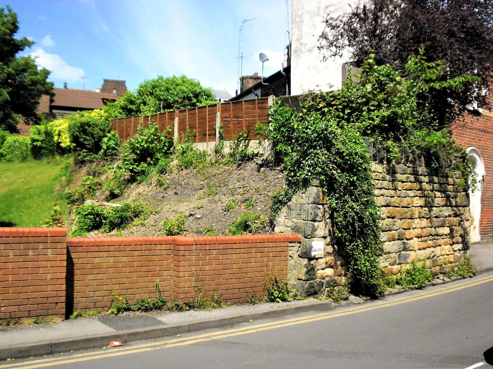
This led to the River Ribble bridge, [above] a concrete replica of the original timber structure which it replaced in 1965. At least one stone sleeper block forms part of the south abutment while others lie on the river bed near the north bank. The northernmost bridge span is not horizontal as it is the foot of a second incline which ascends through Avenham public park. Beyond is largely lost but in Garden St, just east of Preston station, a stone bridge abutment survives , possibly in public ownership as an Engineer's Line Reference Code 'LJR/00' is painted on it. [below]
Following a lunch break in and around the station we met on the 'rare' P7, the ELR side of Preston, hence the eastwards curve at its south end. Former railway land to the east is a car park and shopping mall. We viewed what remains of the ELR formation before returning to Avenham Park and rejoining it at its own Ribble bridge which marks the north end of the 'Preston Junction' reserve. The ELR bridge provides good views of the tramroad and WCML bridges up and downstream respectively. It led us to the site of Whitehouse North Jn where we took the west curve, opened in 1900 to allow trains off the former West Lancashire Railway (WLR) Southport line to be diverted to the ELR station. Joining that at Whitehouse West Jn we passed under the WCML bridge which still has its full complement of 6 tracks.
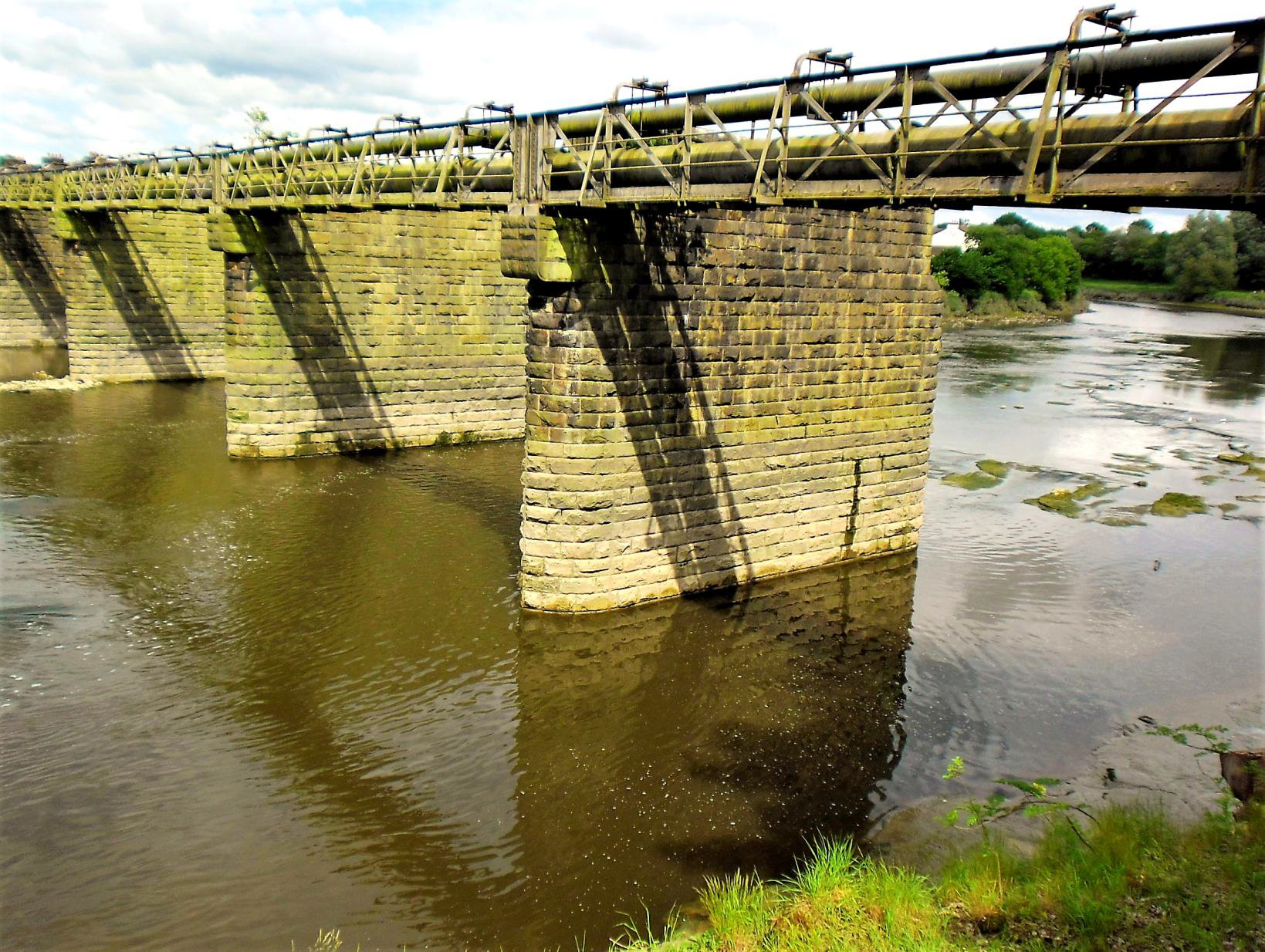
A short section of road walking where the line has been lost to redevelopment brought us to a further railway triangle; Middleforth, Penwortham and Ribble Junctions were the apexes. Curving wooded embankments remain on all three sides and within them is a former caravan site now mainly occupied by modern chalet-style 'park homes'. It has a secluded air even though a public footpath bisects it, passing between bridge abutments at each end; this was our route! A further short road stretch brought us to the river again; the decking of the WLR bridge across it has long gone but the stone piers remain and support a pair of pipelines. [below]
Immediately downstream is the 1759 built now Grade II listed Penwortham road bridge (closed to vehicles these days). Crossing this, we followed a tarmac path approximately on the course of the WLR to the site of its terminus, Fishergate Hill from 1904. It lost its regular passenger traffic to the ELR station in 1900 (above) but remained a goods depot until 1965, covering a large site now completely redeveloped. Fishergate Hill GP Surgery occupies the passenger station site. All that remained was to walk up the eponymous hill to the present station passing over the Preston Dock branch of which only glimpses can be seen.
Thanks to Paul Steane for a most interesting walk, detailed notes, the map distributed before and his walk commentary. All helped make sense of a complex area, also for his sense of timing as, following a fine day, the heavens opened about 5 minutes after we finished! Preston is a city which owes much to its railway heritage for its present outdoor recreational facilities and has used it to good advantage.