With a title like that and only 12 places available, I knew this would fill quickly! From the 1790s to HS2, it had tremendous variety - including a Jewish burial ground, a viaduct built on top of a viaduct and a listed cast iron gentlemen's convenience.
We met in front of Millenium Point. Behind us was steam locomotive 46235 'City of Birmingham' in 'Thinktank', a modern Museum; in front was the vast HS2 building site, soon-ish to be the biggest building in Birmingham and expected to win architecture awards .... the new Curzon Street HS2 station.
The viaducts at the station throat are taking shape but it was sad to learn that only three of the seven platforms will have track (at least initially) and the only train services will be to and from London.
The 'third side of the triangle viaduct' at the delta junction located along the track near Water Orton is being built without the track necessary for trains to run between Birmingham and the north. In both cases this is cheaper than redesigning the station and viaduct and may be needed one day, hopefully.
Our guide for the day was none other than Adam Turner. He has built up a track record of excellently devised, researched and resourced visits. The day lived up to all the promise.
The first highlight was just round the corner in New Canal Street. So why, you might wonder was the station called Curzon Street? It turns out the Hon Penn Assheton Curzon married the niece of the Birmingham landowner Charles Jennens whose estate included the location. When opened in 1838, it was simply called 'Birmingham'. With four Ionic columns, 45ft high, reminding us of the former Doric Arch* at the Euston end of the line It Is a remarkable survivor, now requiring structural work but Grade I listed and to be part of the HS2 station. [*Sadly, the Doric Arch was demolished at the end of 1961.]
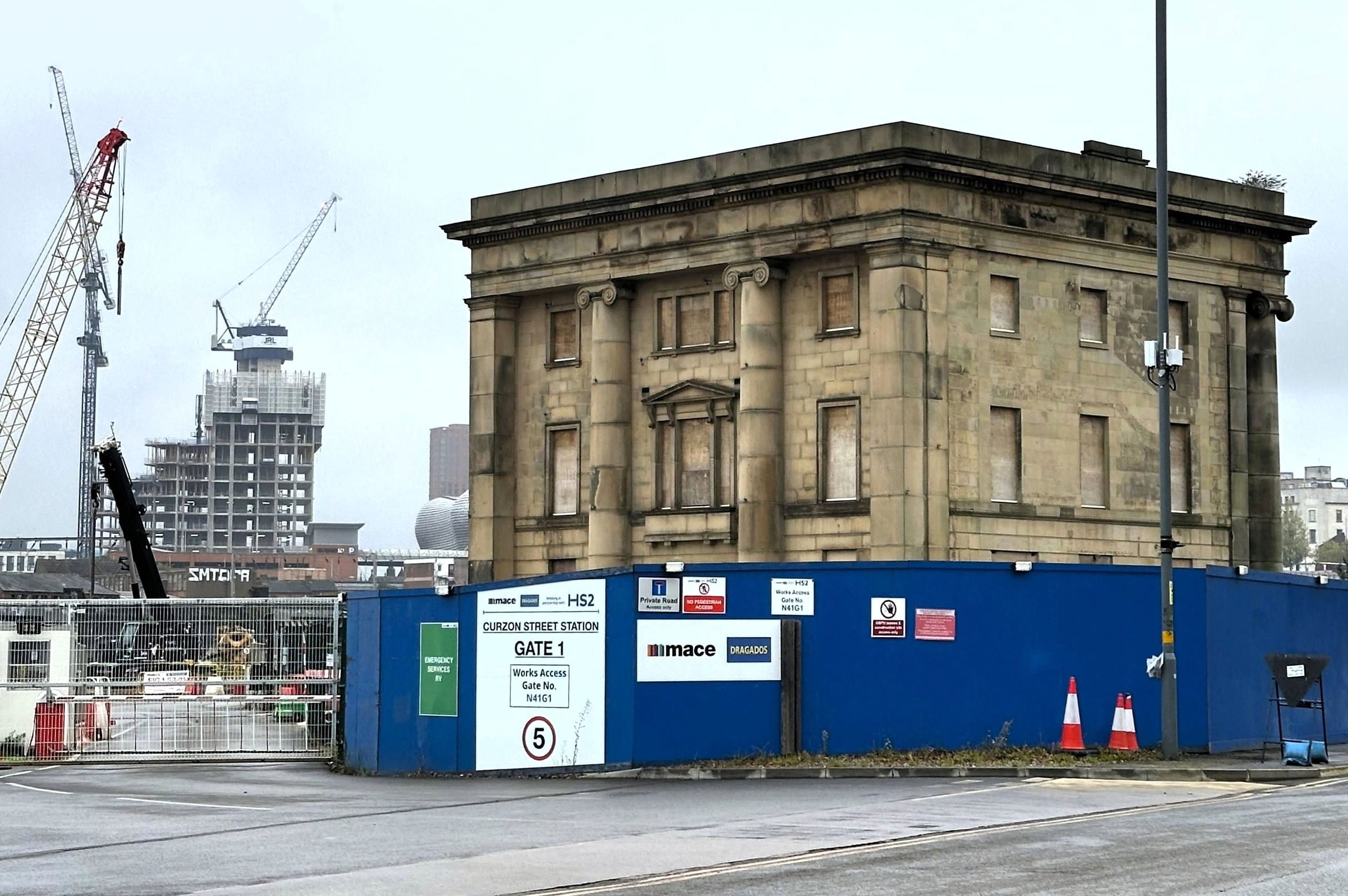
Lower left of the original Grade I Listed Curzon Street station building is the bulbous end of Selfridges store by Moor Street station.
[© Keith Flinders 2024]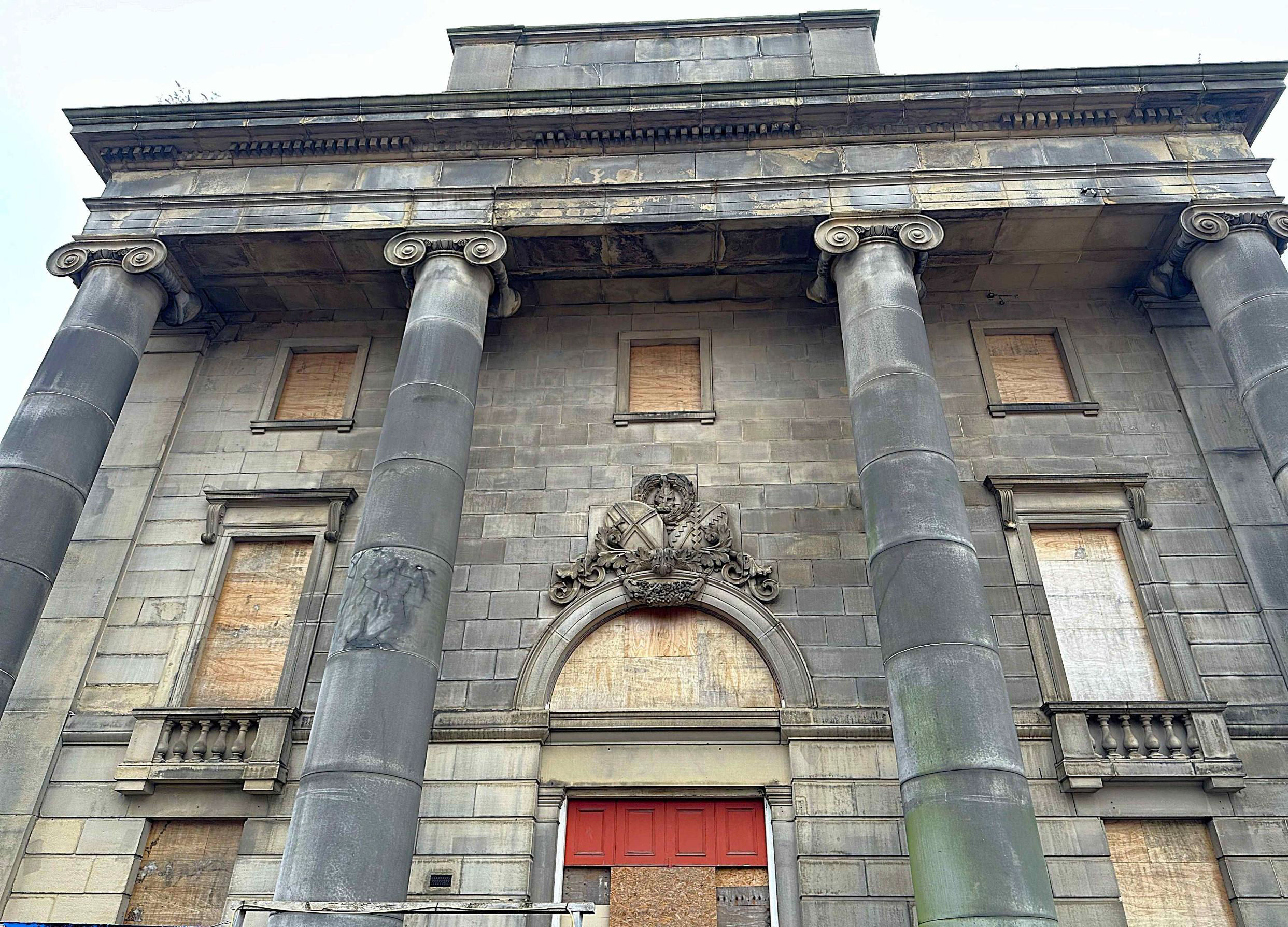
The front of the building will need much restoration work.
[© Keith Flinders 2024]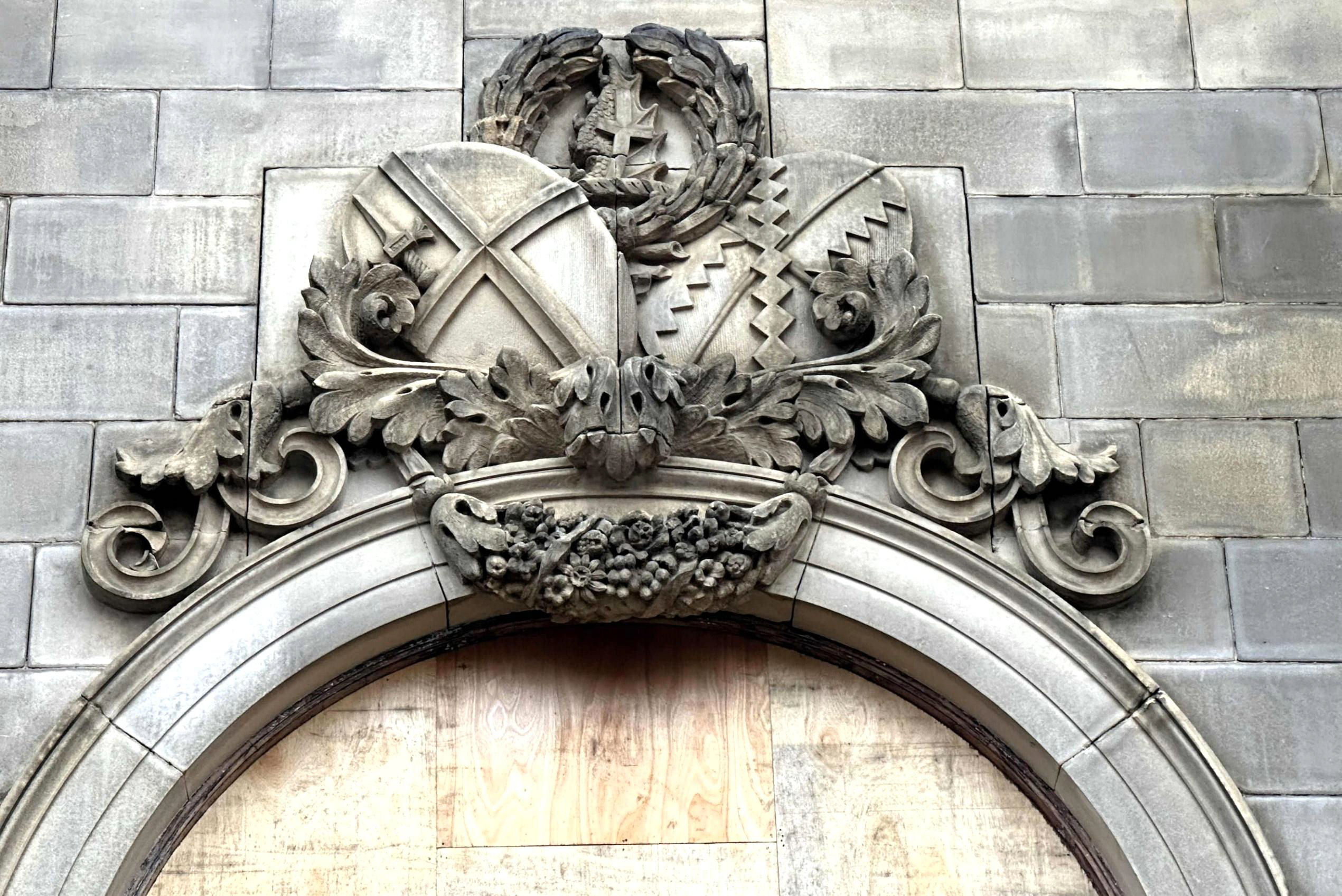
The London & Birmingham Railway crest above the station entrance.
[© Keith Flinders 2024]Alongside the London & Birmingham Railway terminus, the Grand Junction Railway extended from its first station, called Birmingham (Vauxhall), close to where Duddeston now is. As we walked along Curzon Street itself, Adam pointed out some sections of wall that are still original stone from 1838!
The Grand Junction Railway wall along Curzon Street itself includes some of original 1838 stonework, such as the bottom two courses here.
[© Keith Flinders 2024]We were now as close as we could be to the piers being constructed to hold up the new Curzon Street station approach. With clean, white concrete, the platforms will be at first floor level, though with the land rising towards the buffer stops, these will be at ground level and very close to Moor Street station. Underneath will be busy, (rather like St Pancras), including a new West Midlands Metro stop.
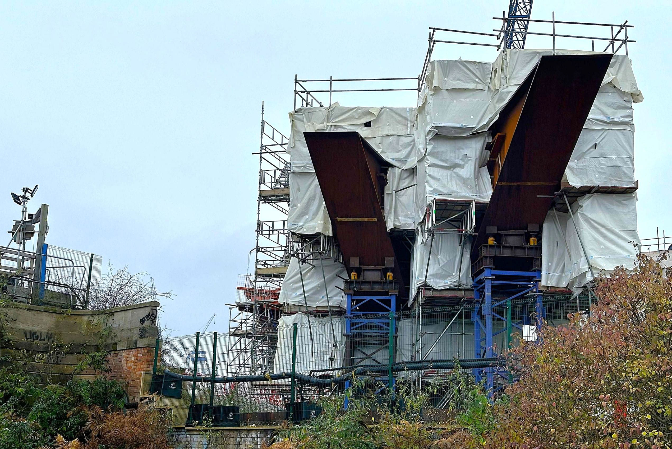
The new viaduct to Curzon Street station will take HS2 over the lines to Aston and Water Orton, before it drops down into Bromford Tunnel.
[© Keith Flinders 2024]We walked to Lawley Middleway to see two listed viaducts. The first was Joseph Locke's 1838 viaduct for the Grand Junction Railway, notable for being one of the earliest English major large-scale railway structures, having 28 segmental arches. In 1893 a viaduct was added atop the 1838 structure, as part of works to permit access to Curzon Street and New Street - understood to be a unique 'double-deck' viaduct! There is a good view from trains going over it. We then walked further on to see one of the impressive 50-foot arches of Robert Stephenson's 1838 viaduct for the London & Birmingham Railway.
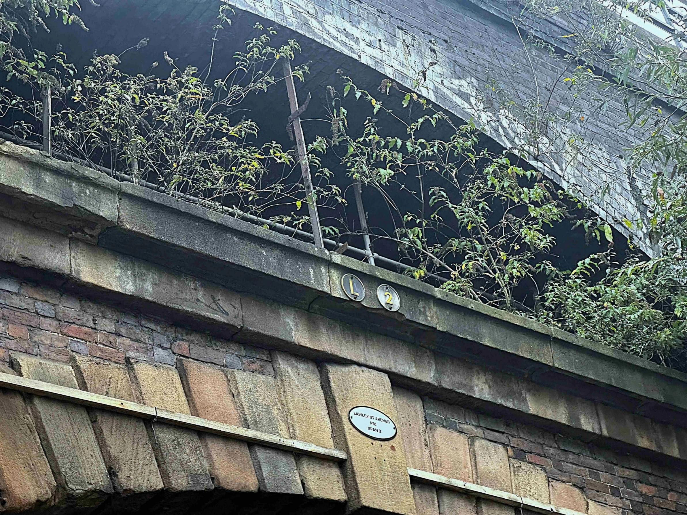
From road level near Proof House Jn, the 1893 brick viaduct built on top of the original 1838 stone and brick viaduct.
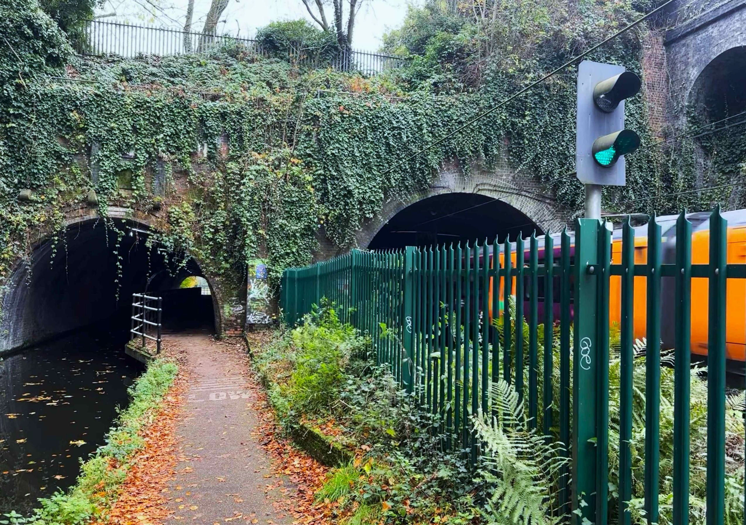
[© Keith Flinders 2024]Returning to where Curzon Street crosses the canal, we joined the towpath for our first canal tunnel. It was the 103m long Ashted Tunnel. The narrow towpath, less than 2m, explains why boatmen's horses always had stiff necks. This was the Digbeth Branch Canal that linked the Grand Junction and the Birmingham & Fazeley Canals, just 2km apart. It needed its own pumping station, in use until 1922, as the canal had a tendency to leak. Birmingham has 35 miles of canals; said to be more than in Venice.
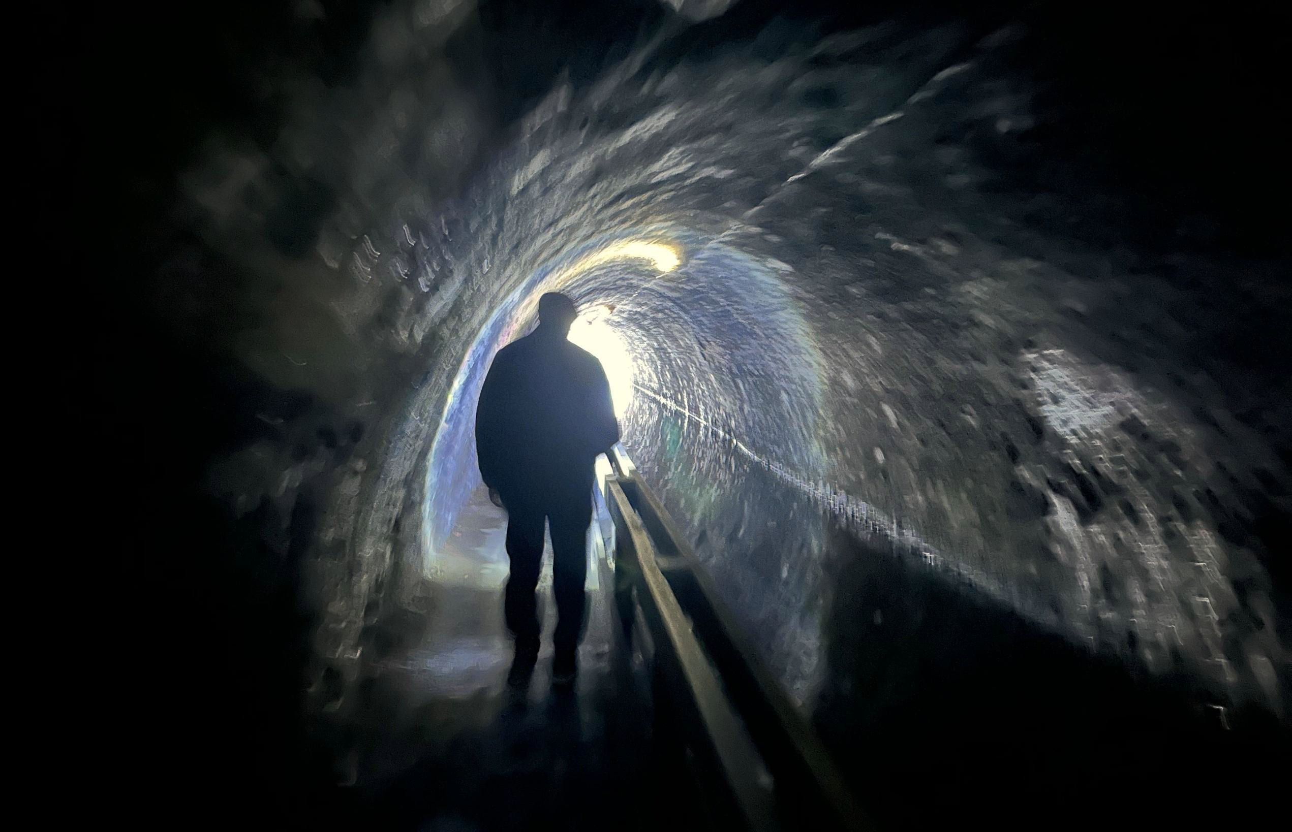
Ashted Tunnel on the Digbeth Branch Canal; until 1928, the water level was maintained by a Boulton & Watt pump, now at a museum - in Detroit!
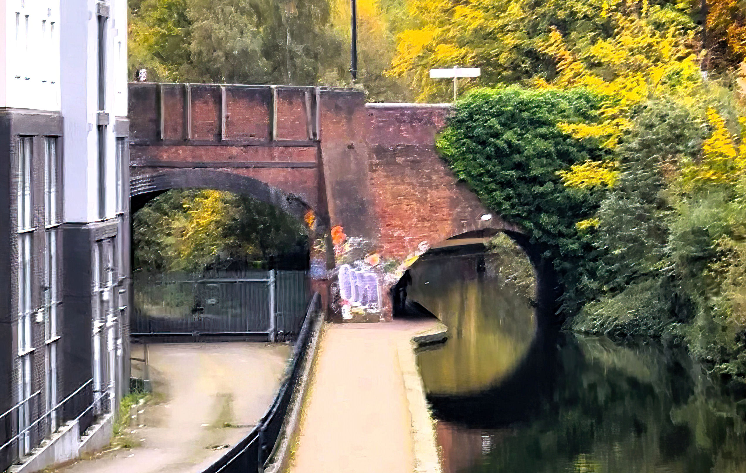
[© Keith Flinders 2024]We walked to where AstroTurf is being laid on the canal bank, probably the result of soil pollution rather than a misguided attempt at creating a linear nature reserve. Returning south took us through Curzon Street Canal Tunnel, 200yd long, and altogether grander. Built by the railway companies from the 1830s to take their tracks over the canal, it followed a wide, sweeping curve and had clearly been widened several times over the years in different styles. Were they showing off? According to Joe Brown's West Midlands Railway Atlas, by 1950 there were about 24 tracks across the top of the canal tunnel (now there are six). Another two used to be at a right angle to the tracks into Curzon Street station, accessed by wagon turntables to transfer goods between canal and railway on the opposite side to our towpath.
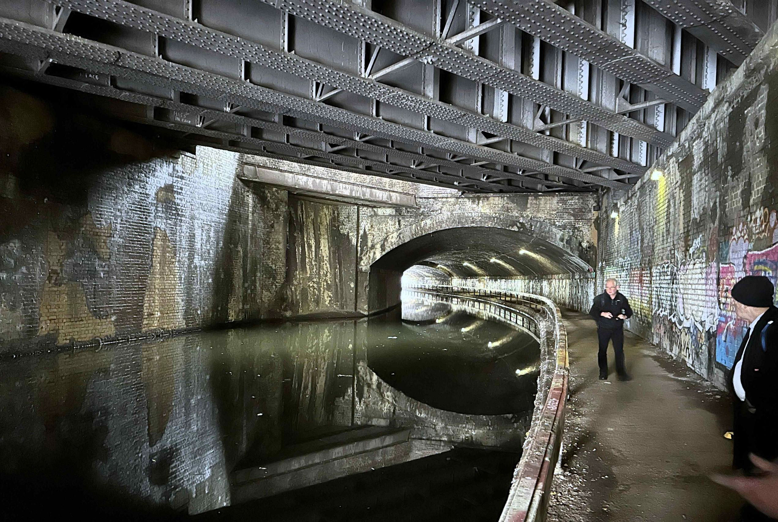
Curzon Street Canal 'Tunnel' is a set of railway bridges (24 tracks once) over the Digbeth Branch Canal. Note how wide the tunnel and towpath are.
[© Keith Flinders 2024]Our group walked on to Proof House Jn, seeing the splendid 1813 building that gave the rail junction its name from the other side to usual. This was built to test out guns made in Birmingham. We were close to Typhoo Basin but no time to stop for tea. Was the colour of the water a clue to its name? Next was I K Brunel's 1852 Bordesley Viaduct that dominates the Digbeth area. Below an arch at Allison Street, hiding in the gloom, was one of the highlights of the day - the 1880 cast iron Grade II listed gentlemen's convenience, with decorative cast iron panels. It was pure Peaky Blinders but is now secured out of use.
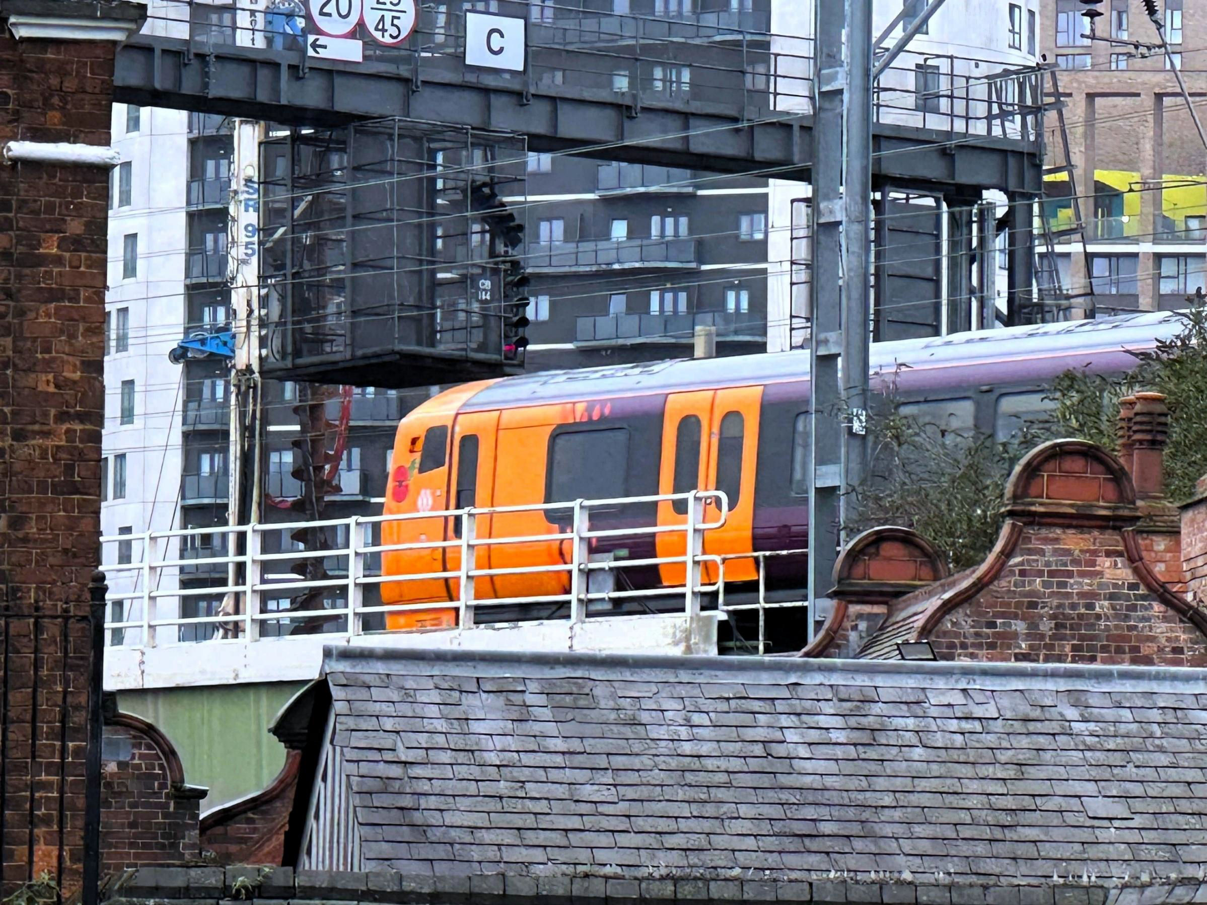
Birmingham Proof House from the back and Proof House Jn from canal level as the 09.39 Lichfield to Bromsgrove passes by. This EMU, 730029, had a Remembrance Day poppy by the cab for the next weekend.
[© Keith Flinders 2024]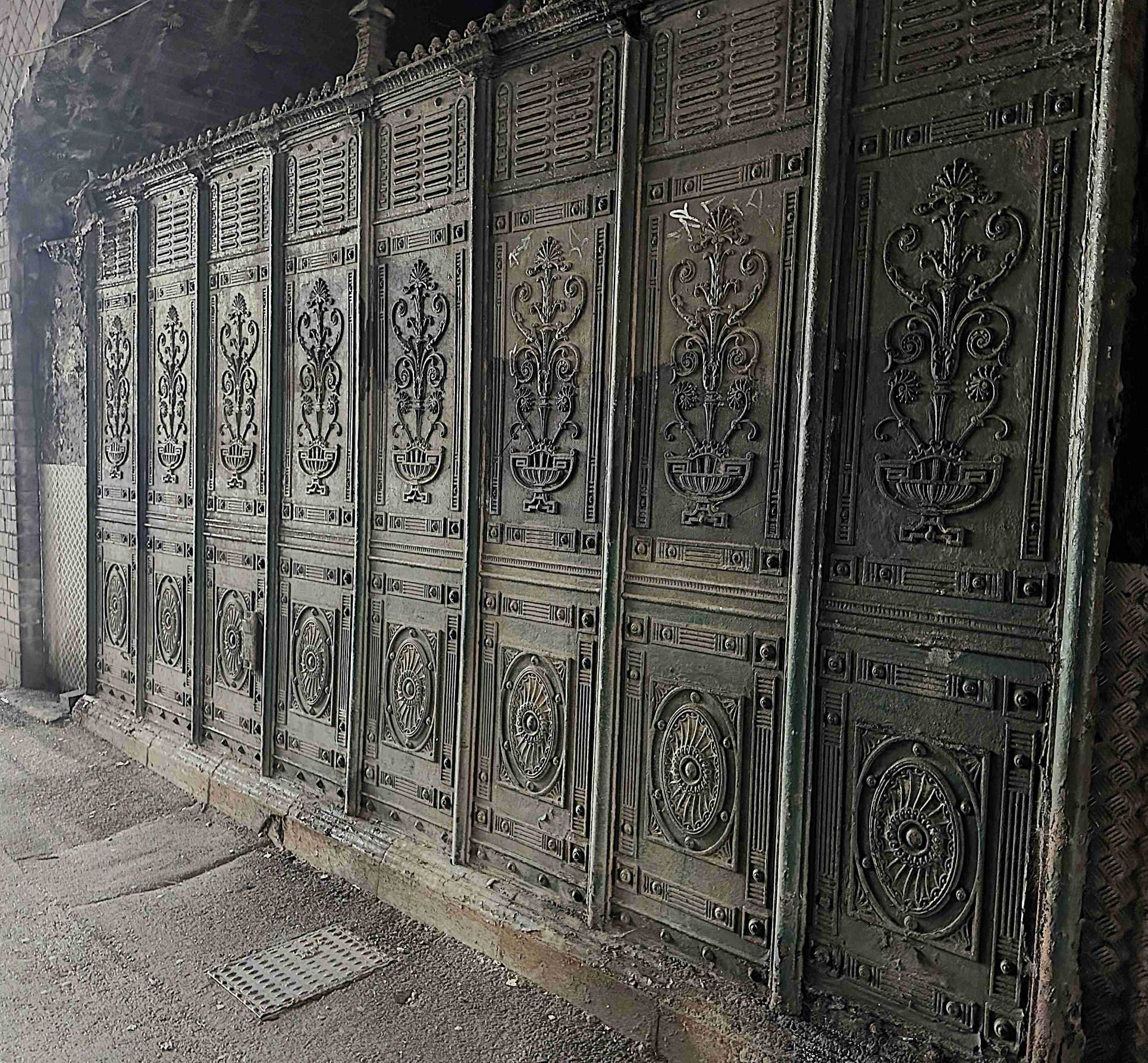
In case you wondered what a Grade II listed gents' looks like. Once a feature of Birmingham, these urinals, also known as 'Temples of Relief', were made of ornate cast iron panels. Often found beneath railway bridges, this is in Allinson Street, under the south end of Moor Street station.
[© Keith Flinders 2024]Opposite, under the south end of Moor Street station, is the entrance to one of the Bullring (one word) car parks, originally part of the Great Western goods station complex (Shed B), handling fish, fruit and all sorts of market goods that were lowered down by a wagon lift system, very convenient for the original Bull Ring Markets (three words). It is notable for its use of reinforced concrete, elements of that original structure survive as part of a Bullring multistorey car park. We ascended to the splendidly restored station at Moor Street. This presented an ideal moment for a brief pause to enjoy a drink from the GWR period style Centenary Lounge on the compact concourse. The GWR built this beautiful little terminus, also now Grade II listed, for its new services from the North Warwickshire Line in 1909. It has a warm and welcoming feeling. Next time you visit, look under the bay platforms close to the buffer stops where there were traversers to slide locos across to the next track, rather than having crossovers to run round. There was just time for a brief sit down, as we took a Class 172 ride through the tunnel to Snow Hill P1. It was a crime of the 1970s that the beautiful 1912 GWR station was demolished, then replaced with concrete for reopening in 1987 as a multistorey car park, with two island platforms hiding underneath. It may not be long now before the car park is removed and P4 is restored but, undoubtedly, an office block will replace it (rather like the ones on its northeast side, including HS2 headquarters).
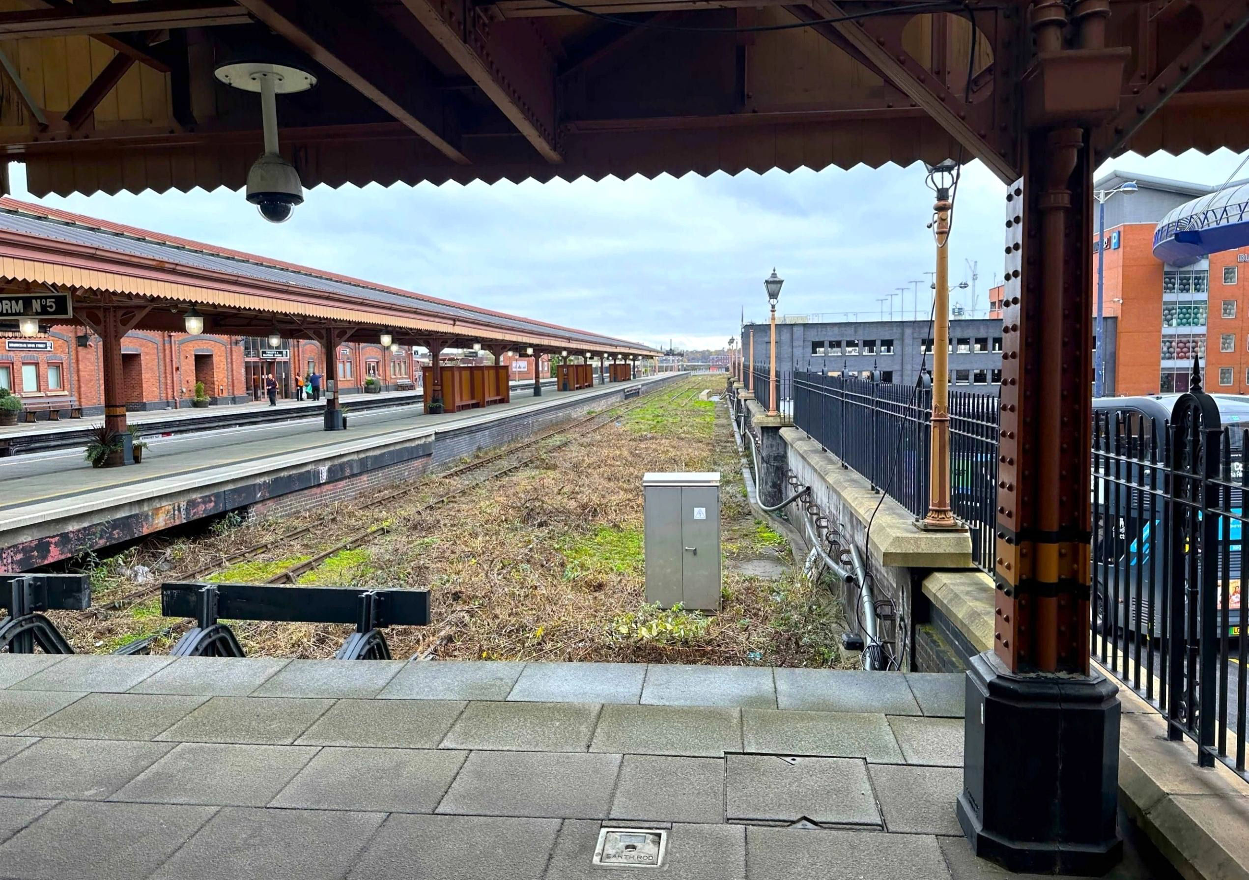
Moor Street station looking towards London. So that trains could use the full platform length in this cramped site, two electric powered traversers were used until 1967 to move steam engines sideways between tracks. There is still the gap there underneath the platforms. P5 on the left is not connected to the network at the far end.
[© Keith Flinders 2024]As we left P1, we discussed another tunnel we had heard about but could see no trace of. It went from somewhere within Snow Hill tunnel at about a right angle to under the Bank of England building near the Cathedral and was used during the night to transfer bank notes and bullion. If anyone knows more, sharing would be appreciated. Our next venture was walking along some of the roof of Snow Hill Tunnel - The Great Western Arcade, with some esoteric shops. Then it was back to the corner of Livery Street to compare Adam's old photos of the front of the GWR station (a hotel) with now. Further down Livery Street, we came to the last reminder of the 1912 station, the side entrance, with the GWR crest over the arch. In the early 1970s, when Snow Hill had just a handful of rush hour trains to Wolverhampton Low Level and Langley Green, it was the passenger entrance to 'the largest unstaffed halt in the world'. At the end, only two bays of the 12 platforms were used and all trains were 1-car DMUs or 'bubble cars'.
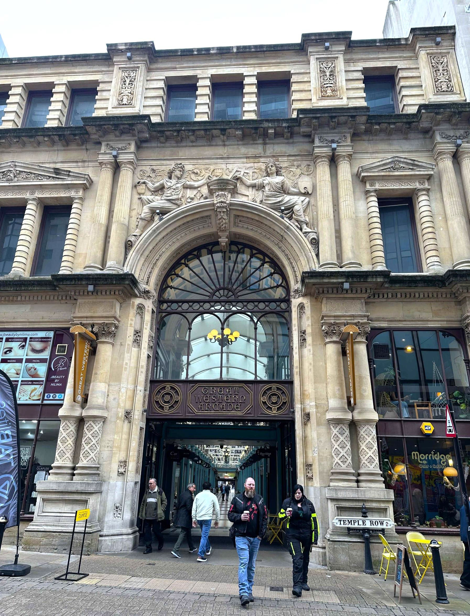
Opposite Snow Hill station entrance is Great Western Arcade. Its continuation to Corporation Street is called North Western Arcade and is the simplest direct walking route to New Street station.
[© Keith Flinders 2024]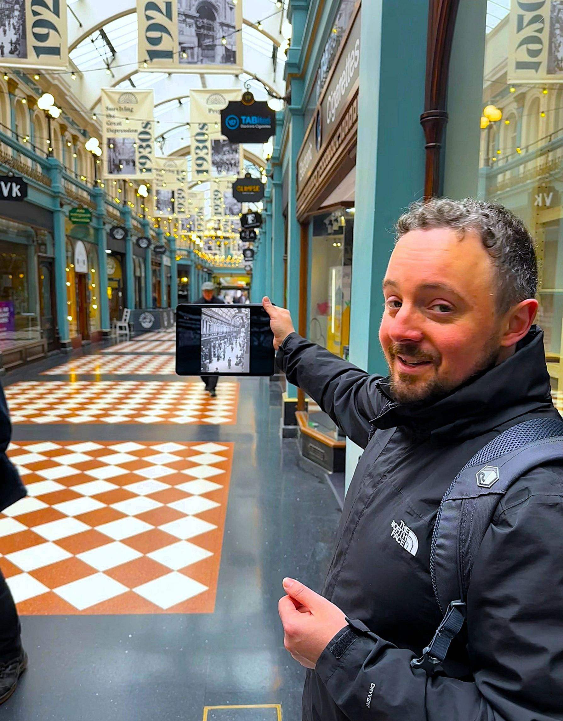
Cut and cover, above Snow Hill Tunnel, Adam Turner holds an early photo of the Great Western
Arcade, revealing that not much has changed. [Artificial Intelligence (AI) auto-captioning thought it was a 'person taking a selfie in a mall' - clearly, we have nothing to worry about over AI ... yet. How do you turn it off?]
[© Keith Flinders 2024]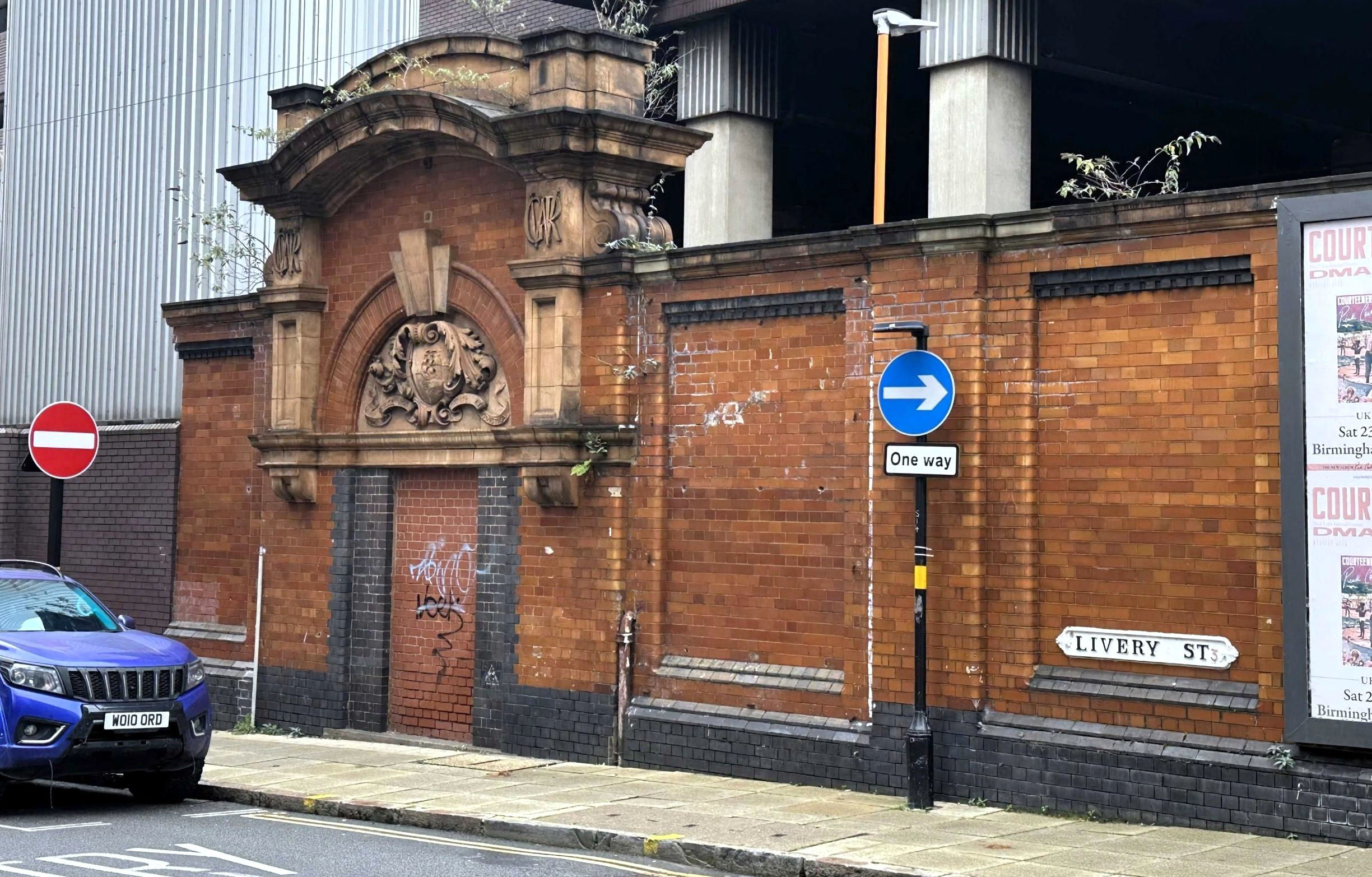
The remaining portion of the 1912 Snow Hill station, this bricked up gateway was the passenger entrance in the station's final days.
[© Keith Flinders 2024]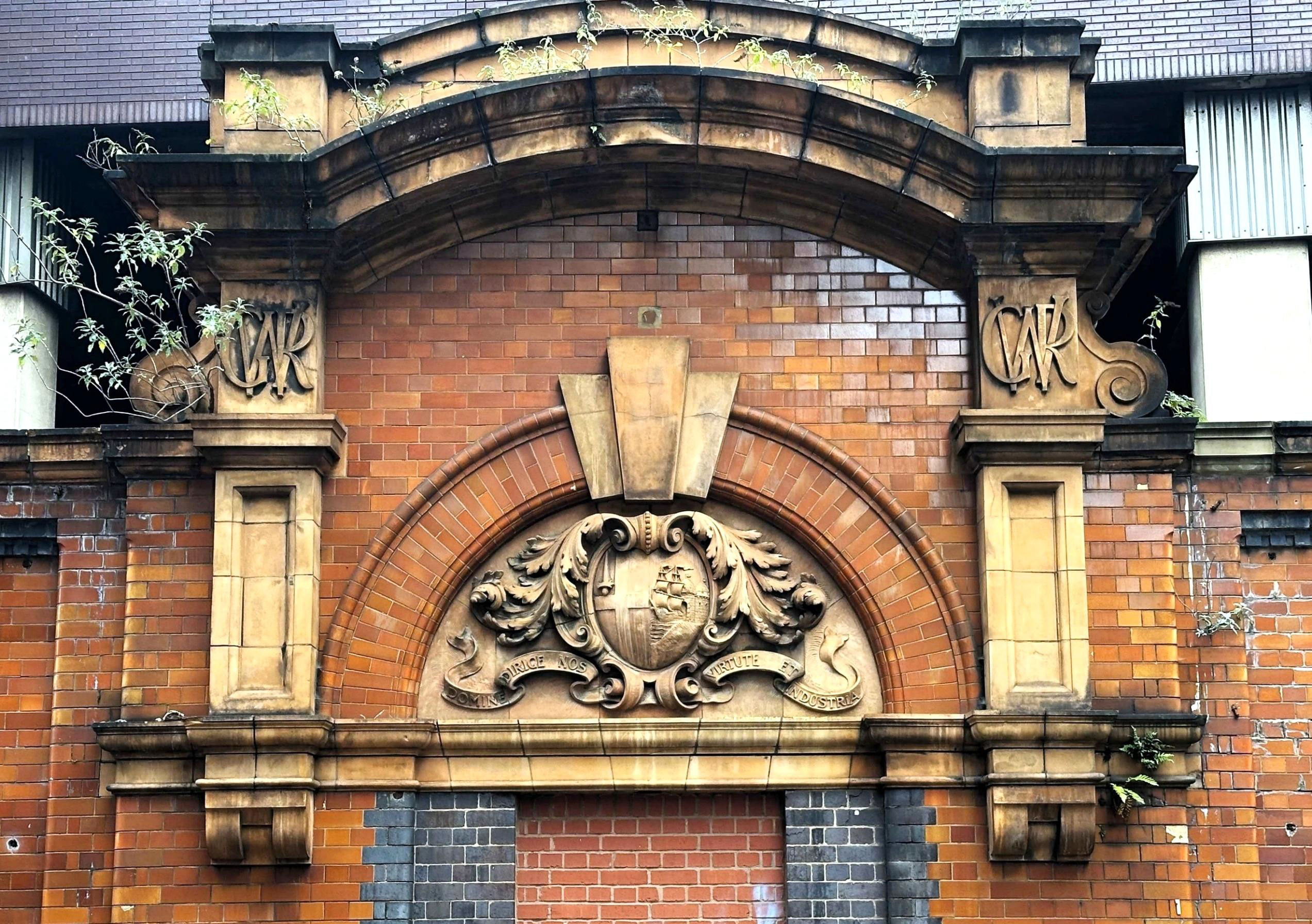
The Great Western Railway crest includes the heraldry of the cities of London and Bristol.
[© Keith Flinders 2024]We walked on to St Paul's Metro stop, stopping to observe the monumental brick arch carrying the lines into Snow Hill over the Birmingham & Fazeley Canal deep below. We also noted the various light blue bridge decks (some arched) in the Henrietta Street arch. Why is it that St Paul's stop has an apostrophe but the next, St Chads, does not? We took Tram No45 for eight stops through the city centre as far as it now goes to Edgbaston Village. (There is a natural 'village green' between platforms.) This is good value at £2.20, better than having to walk through the Frankfurt German Christmas Market crowds, which had started the day before. The ride included a stop just called 'Library', outside Symphony Hall. Underneath it is New Street North Tunnel, so the hall was built on rubber pads to absorb vibration. It seems weird to have trams without any OHLE in places now on the line, although the batteries have been a success.
The tram track ends at Edgbaston Village, for now. Eventually it may go further along Hagley Road towards Quinton and Halesowen. There is a scissors crossover and two platforms, used alternately. We took the crossover to the right. Each platform is long enough to hold a spare tram or breakdown but ours had a low tech 'Stop' marker halfway along the track, an upright piece of metal in a concrete block. Tyre tracks in the grass suggested someone had tried to drive to the end of the line and moved it.
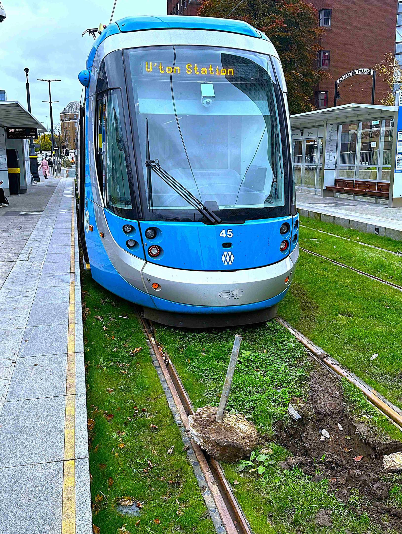
Edgbaston Village tram terminus looking away from the end of line.
[© Keith Flinders 2024]A short bus ride, for those who chose not to walk, took us next to the towpath of the Worcester & Birmingham Canal, alongside of which is the West Suburban Line, now Cross-City South. The canal, of course, came first being constructed from the Birmingham end between 1792 and 1815, when it reached Worcester. The railway was added on the west side in 1876 but the students jogging and cycling are a more recent feature. We walked through Church Road Tunnel and Adam pointed out and showed us old photos of the layout of the former Church Road station, which closed as early as 1905.
Church Road Tunnel and (closed 99 years ago) Church Road station site. Left is the canal tunnel, the only one of the five on the Worcester & Birmingham Canal with a towpath.
[© Keith Flinders 2024]Next on the agenda was Church Road Jn. The original West Suburban Line carried straight on to its Granville Street station terminus until 1885 and Birmingham Central Goods beyond that until 1967. This is the land by 'Mailbox Birmingham'. From Church Road Jn, the Midland Railway provided a link to New Street through Holliday Street Tunnel in 1885. Curiously, the double track original route from Church Road Jn to Granville Street appeared to split into two single lines, each with its own single track tunnel. We crossed Islington Row, Birmingham's Middle Ring Road, to investigate. As usual, Adam had the answer. This piece of land in between the tracks had been a Jewish burial ground before the railway arrived. The tracks had to go round it either side - definitely a branch that needed to be done both ways!
The original West Suburban route to Granville Street passenger station paralleled the Worcester & Birmingham Canal north of Church Road Jn. The canal is about to make a right angled turn into Gas Street Basin and the railway drops down to tunnel beneath it.
[© Keith Flinders 2024]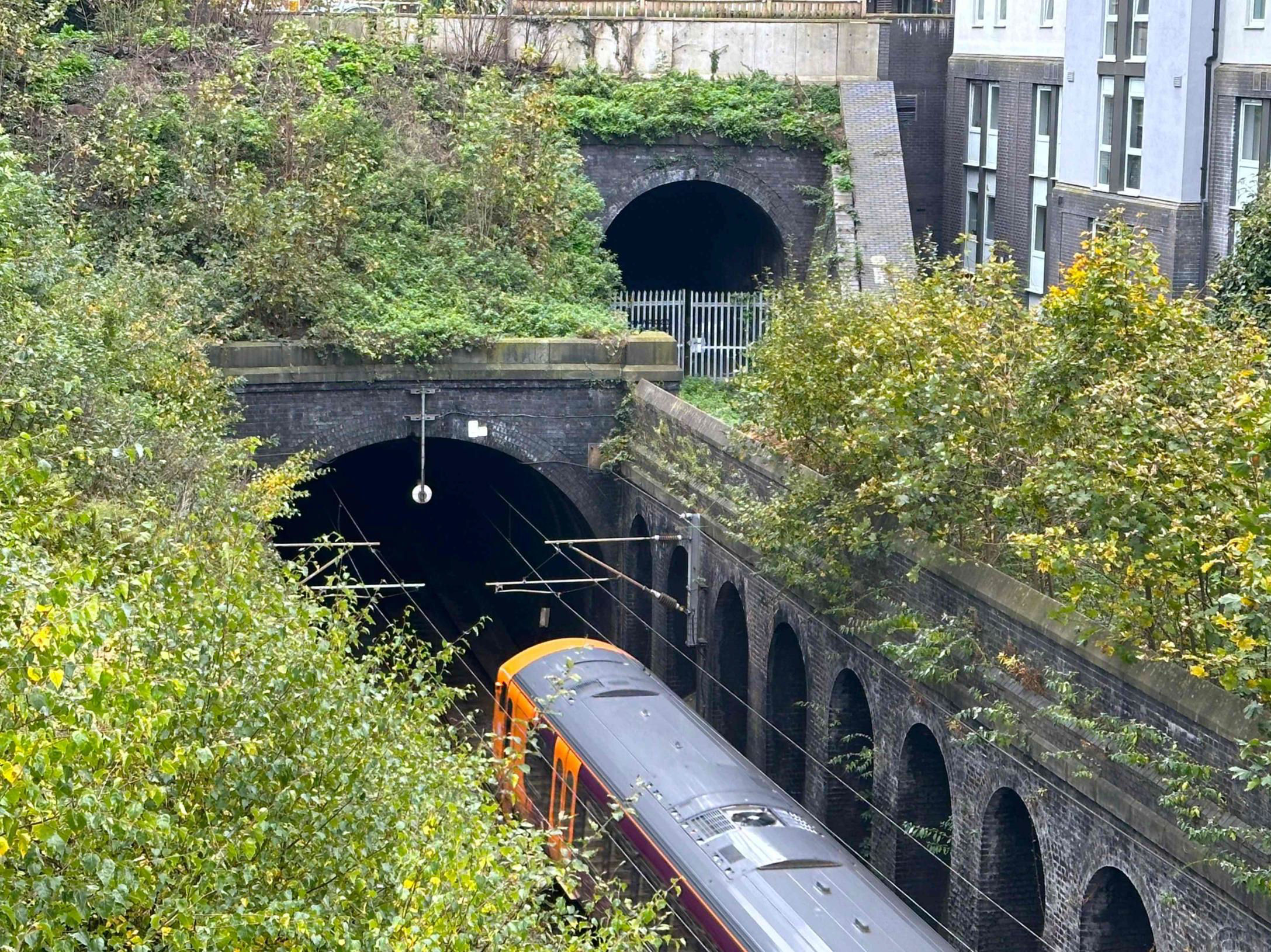
After splitting into two single lines to pass either side of the Jewish burial ground, the Up trackbed (from Church Road Jn to Granville Street) is top right. At the lower level, the 13.16 Four Oaks to Redditch climbs out of Canal Tunnel on the 1885 link from Birmingham New Street station.
[© Keith Flinders 2024]Our final destination was Bournville, so we had another short ride, this time from Five Ways on a smart new Class 730 EMU. Expecting the normal 6-car set, participants had to hasten along the platform when just a 3-car materialised. When deciding to move out from the centre of Birmingham, in 1879, Cadbury's choice of location was influenced by the presence of the Worcester & Birmingham Canal and the West Suburban Railway. Cadbury's bought its own steam engines, the first in 1884; a 1925 replacement, Cadbury No1, has been donated to Tyseley Locomotive Works (as now named). Eventually Cadbury's had six miles of track, including some very tight radius curves around the entire complex, meaning short wheelbase wagons only. There was also a connection towards Selly Oak used by three outbound trains a day until 28 May 1976, worth 'hitchhiking'. The internal railway and wagons was the transport between the east canal wharf and warehouses that side to the factory west of the West Suburban Line. In 1925 a skew rail bridge was installed over the canal (which we saw from the towpath) to a north headshunt on the east side of the canal. Cocoa beans and other goods arrived by canal - the site of the wharf is now largely housing. Of interest, other alignments were considered for the canal bridge; the headshunt could have been on the west side of the canal. Here we enjoyed a small Cadbury chocolate bar - thanks, Adam! A welcome and apt way to enjoy a moment of rest before returning to Bournville for our last bridge.
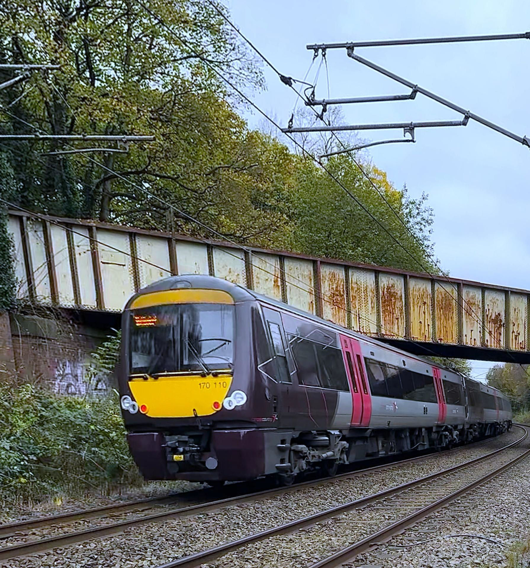
The 1925 skew bridge (which could have been skewed the other way) linked the canal wharf
east of the railway to Cadbury's extensive internal railway. 170110 is on the 12.45 Cardiff to Nottingham.
[© Keith Flinders 2024]Bournville Lane goes under the railway and canal at the north end of the platforms. I had never looked up before to see the damage repair from when a German bomb landed here. This had caused the canal to 'leak' rather badly. So, a really excellent day finished with a 'bang'. Adam was fulsomely and deservedly thanked. He had assembled old maps, plans and fascinating period photos - some showing that graffiti is not a recent phenomenon! It is good to report that this fixture resulted in a donation of £281.77 to St Giles Hospice in Birmingham. [Postscript: Cadbury's has been just 'Cadbury' since 2003.]