The Gorgeous AGM Trackbed Walk - How it came about
Saturday 20th November 2021
Report by Dave Cromarty
The Branch Line Society (Test)
Guest
This walk was documented in some detail in the walk notes sent out with E-BLN 1390 in Dec 2021. Log in to our website and go to 'Archive', set the search 'Category' top left to 'Railway walk' and put 'Ironbridge' in the top right hand 'Search' box. As it went more or less to plan, with tweaks due to the Virus Whose Name Shall Not Be Spoken (because we've all heard enough of it), your Editor and I agreed that a break with the usual report format might be warranted. Consequently these notes have more to do with what was involved in the background than with what happened on the day.
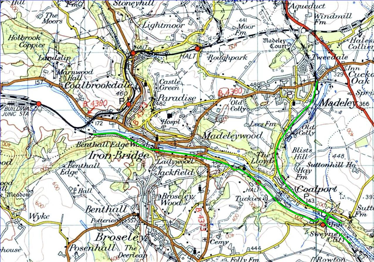
It seemed such a simple idea at first. Helen (one of your Committee) and I have lived nearby for over 47 years now. When Kev asked me if I'd consider leading a walk in the Ironbridge area to complement the Revolution Very Light Rail fixture there which was under development. I thought 'why not, should be straightforward' and agreed without hesitation. I'd studied the L&NW Coalport branch south from Telford Town Centre in some detail for a 19 Apr 2014 Society walk (BLN 1208.171). Recently Helen and I had been walking the last mile or so of that and a mile or so of the GW across the river, each day for our morning constitutional. I thought I knew pretty well what there was to know. Oh, foolish pride!
The plan started with a quick session on Google Maps to determine a sensible route consistent with public transport availability and reasonably thorough coverage of the lines concerned. It turned out that Ironbridge to the power station site boundary, back along the GW to Coalport and up the L&NW to Madeley was about 7 miles. So far, so good. Then there was the landscape. Uncle Google quickly told me that the altitude difference between the two bus stops concerned was 47m, or 154ft.
Well, no point in making it harder, so let's go Madeley to Ironbridge instead. Next stage was to ensure that my 73-year-old legs could cope, before making an idiot of myself by leading a walk I couldn't manage! That was soon established but in the course of so doing I realised I didn't know where the end of the Coalport branch was exactly, save that it was some way beyond the station. I went for a plod through the mud to where I thought it was, but such is the level of undergrowth and, in this geologically unstable area, ground movement, it was less than obvious. To cut this long story short, after two visits it eventually dawned that a photo on my mobile phone would reveal where I was, at least to within 20 metres or so. Armed with 'lat and long', off I went again. The plan didn't work. Several photos taken in different places reported the same location. Why? Coalport is not in Area 51, a term used for classified locations, originally an air base in the USA, https://bit.ly/34KygKJ so why can't satellites see it? Ultimately I was lucky enough to find an Internet photo of the end of the line, buffer stops and all, so I was able to pin down the spot fairly accurately.
Then I started on the walk notes. Madeley Market? Easy; the station building is still there. Legges Siding (the connection to the Blists Hill Brickworks)? Ah, where did it leave the branch? You try finding a map with it on it. When you do, leg it down Legges Way (the road built on that portion of the branch alignment in the 1980s) and try and fathom out where it was. I settled on lamppost MY460 as a best guesstimate, but I'm still not convinced. Just down the road there's a quite spectacular, by horse tramway standards, bridge which carried a tramway from Meadowpit Colliery in Madeley, to Blists Hill. It featured a steam worked incline, the remains of which I thought we should look at on the walk, together with the tramway rails still embedded in the car park of the All Nations, my 'local'. More research revealed that it had been called 'Baguley's Wind' (to rhyme with dined) after a pub landlord of the time, which explained why to this day, locals call it 'The Wind'.
Then there was the tramway from Blists Hill to clay pits above Ironbridge. How, I had often wondered, did it cross Coalport Road? The levels seemed all wrong. More research resulted in the discovery that there had been an underbridge and that on our many morning walks I'd completely failed to notice the tramway alignment at a lower level (in my defence, there's no trace of that bridge now).
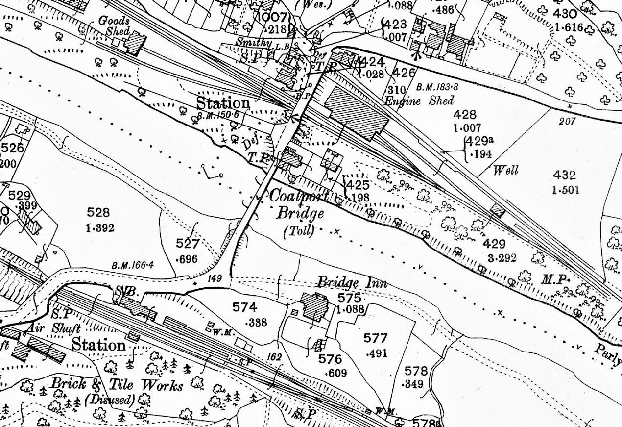
And so it went on. Coalport China Works Siding. What? Again more research, eventually pinning it down, more from local garden boundaries than anything else. 70 years of encroachment since closure makes it less than obvious. At least the GPS signal worked there. Over the river, and there's the Coalport Brick & Tile Works and its little twig off the GWR (towards Bridgnorth). And I thought it was a sewage works. Well, it is - but on the tile works site, although just to confuse the issue, its access road parallels the former GWR 'twig' but is not on it. Anyway, the walk route acquired half a mile by going to look at the remains. Coalport GWR station is now the home of two ex-BR Mk1 coaches used for holiday accommodation, as well as both original platforms and their buildings. More homework in the form of emails obtained us permission to have a look round as long as we didn't disturb the paying guests. On the day we were made very welcome by the owner who showed us a rather mysterious ex-military structure close to the station. Hmm... Perhaps Coalport is in Area 51, after all.
The next stretch took the walk along to Jackfield. Think 'tile works'. They are, or rather were, all over the place and much further research was required to establish what was connected to the railway, where and how. Only Maw's (once the world's largest) survives, accommodating some flats, shops and craft workshops, along with Craven Dunnill which is mostly museum but does still make tiles on a limited 'bespoke' scale. My researches took me into many digital 'rabbit holes' (those things you end up looking at because they're interesting, not necessarily relevant!). However, eventually it provided, inter alia, the background to the relocation of Jackfield Halt (originally OP 3 Dec 1934), necessitated by a major landslip at the first site just west of Maw's, thought to have been in Apr 1952. The (new) wooden halt OP 1 Mar 1954, 18ch further south just east of Maw's.
I learned about the Doughty Fault (part cause of the landslip), encaustic tiles ( https://bit.ly/3fp8kGL ) made by Maw's and Craven Dunnill, and religion in the East Shropshire industrial area (more 'rabbit holes'). The latter resulted from our route passing a former Wesleyan Methodist chapel as well as St Mary's church, whose interior showcases the products of both Maw's and Craven Dunnill. [Participants who had walked the trackbed at Jackfield previously were absolutely astounded at the transformation of the landscape here following the £17.9M landslip rectification works which concluded in Apr 2016.]
The final section of our walk was to take us through Ironbridge & Broseley station site which was very close to the centre of Ironbridge via the eponymous 1779 bridge but quite a way from, and below, Broseley. Here most of the site remains obvious, though graced by a modern day car park on the site of the station and its eastern approach. There is further evidence in the form of rails in the tarmac of the road leading from the Iron Bridge. A little further west, prompted by a notice board along the path, I located the short lived 'twiglet' off the GWR's Severn Valley line which served the briefly resuscitated Bower Yard Lime Kilns in the 1920s and 1930s. Before reaching the end of the walk at the former power station boundary fence, we were to cross a viaduct which is not too obvious on the path, surprisingly, but clearly visible from the other side of the river where it could easily be mistaken for a retaining wall. One last bit of research was required to find out which it was.
As readers will have gathered, the walk notes required many hours of investigation along with a good deal of footslogging complicated by the temporary absence (due to a six month DVLA renewal delay) of my driving licence. That said, as one with a growing interest in modern history, I found it very informative and rewarding and I would certainly encourage potential walk organisers to get into those digital 'rabbit holes', or their printed equivalents, and hopefully reap the same rewards. [Participants were very grateful to Dave for organising such an interesting, well researched and enjoyable walk.]
| Branch Line Society. A Company Limited by Guarantee - Company No 16743754. Registered in England and Wales. Registered address: 6th Floor, Derwent House, 150 Arundel Gate, SHEFFIELD S1 2FN |